Back Local Government Areas im Northern Territory BAR Local Government Areas im Northern Territory German Luettelo Pohjoisterritorion paikallishallintoalueista Finnish Zones d'administration locale du Territoire du Nord French Az Északi terület közigazgatási egységei Hungarian Local government area del Territorio del Nord Italian ノーザンテリトリーの地方自治体 Japanese Lokale bestuurlijke gebieden van het Noordelijk Territorium Dutch Lista regiunilor din Teritoriul de Nord Romanian Районы местного самоуправления Северной территории Russian


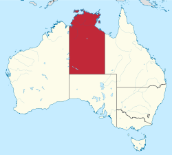
The Northern Territory is a federal Australian territory in north-central Australia. It is the third largest Australian federal division with an area of 1,348,094.3 square kilometres (520,502 sq mi) but the least populous with 245,929 inhabitants as at June 2019.[1] The Northern Territory is divided administratively into 17 Local government areas (LGAs) generally known as Councils who are responsible for providing local government services.[2]
- ^ "3218.0 – Regional Population Growth, Australia, 2018-19: Population Estimates by Local Government Area , 2018 to 2019". Australian Bureau of Statistics. Australian Bureau of Statistics. 25 March 2020. Retrieved 23 August 2020. Estimated resident population, 30 June 2019.
- ^ Northern Territory LGA History Archived 26 October 2004 at the Wayback Machine
© MMXXIII Rich X Search. We shall prevail. All rights reserved. Rich X Search